January 2024—The Explore Cities! app is a result of trying to resist building yet another travel app for over a year. But then doing exactly that step by step.
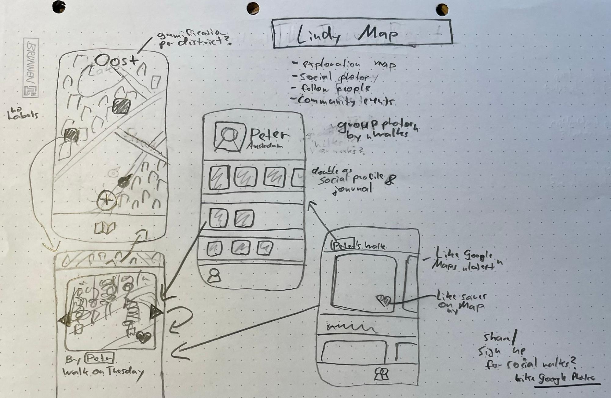
The idea at first was to share travel discoveries with others, with would motivate you and the others to go on more walks. Walk meaning Lindy Walk, so taking a stroll without any specific destination.
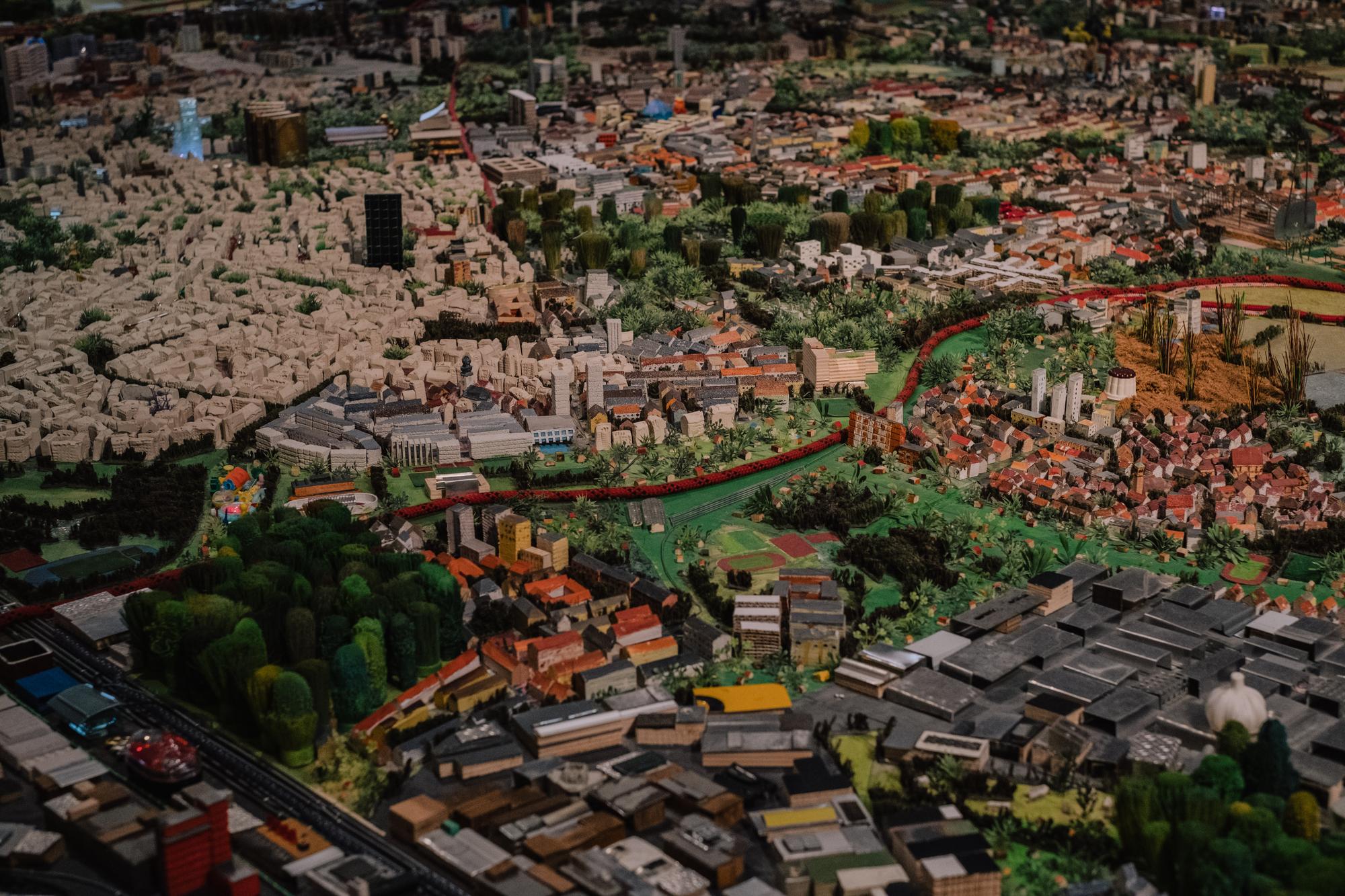
February 2024—Another influence were miniature city models, like one above from the excellent Frankfurt city museum. With all the love I hold for vintage maps, there’s just something about 3D models that makes our brains understand spaces intuitively.
In the current moment, it seems that the purpose of maps (apps) to most people is to take you to a set destination, on the shortest route possible. Ignoring what happens on the way.
Which is not how physical maps work. They show you the layout of a city and what’s where, but you have to decide on a route yourself, and adjust on the way based on what happens. It allows for more serendipity and actually exploring a city.
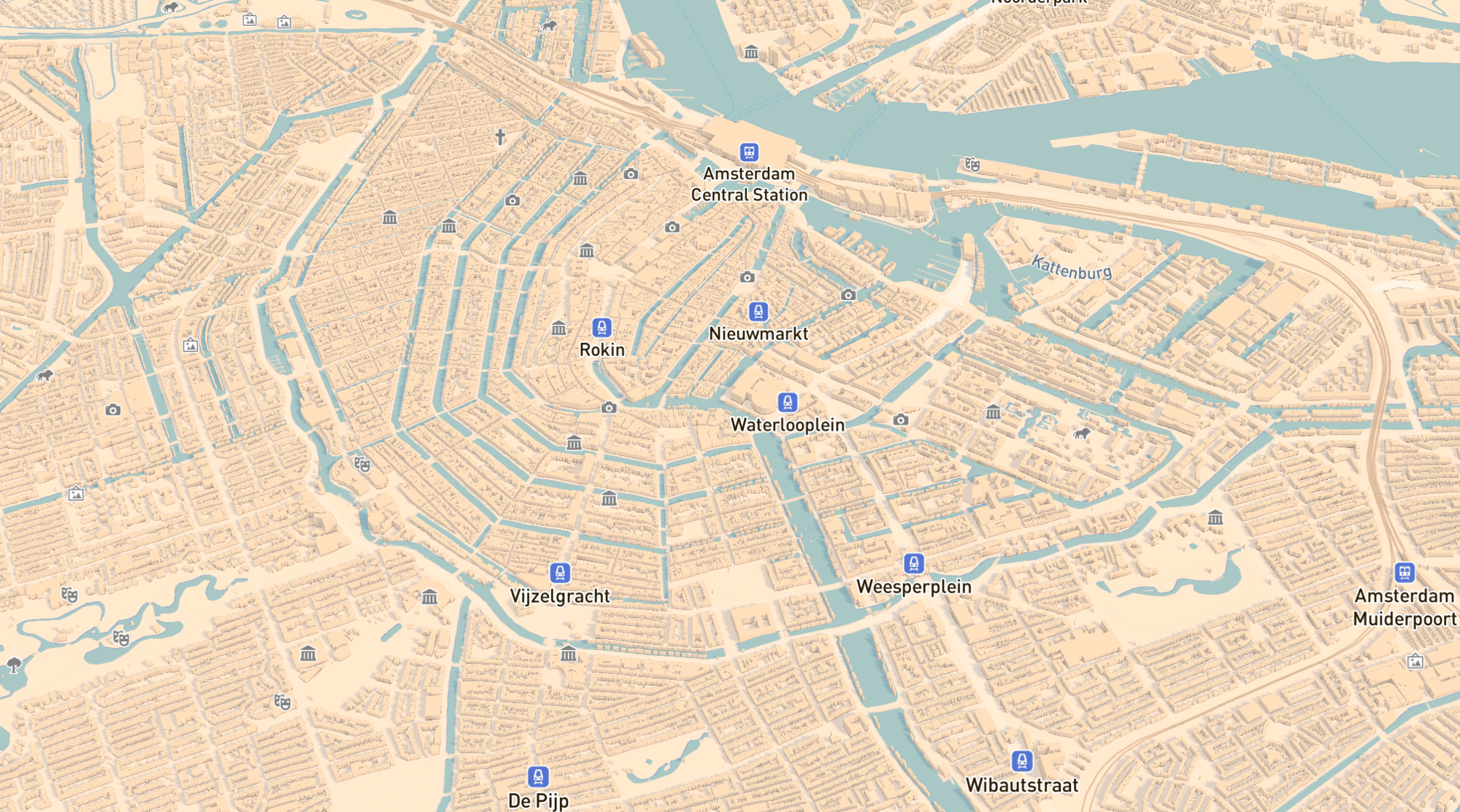
March 2024—Experimenting with Mapbox and Overture, I found a way to render 3D maps of entire cities, much more zoomed out than any other maps app I’ve seen ever.
This requires processing building footprint data for the entire world myself, and self-hosting the map data. The performance on modern phones seems okay.
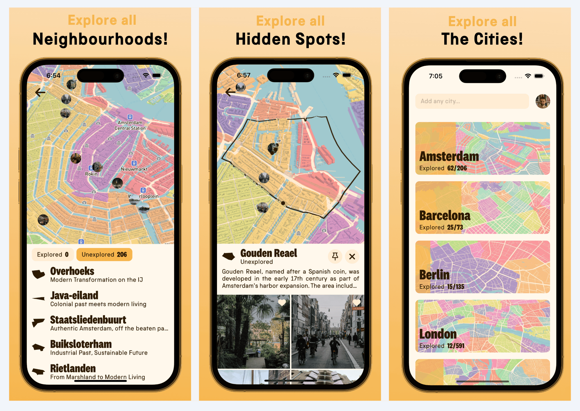
April 2024—Next step: populating the map with at least a few markers, to give you an idea of what to expect in each area. Maybe museums and “secrets”?
Now the process of using the app looks like this: open the map, walk in the direction of the nearest icon, check out what’s there in the real world, and repeat.
Results of real world testing: while it turned out to be more fun than Google Maps, you were still chained to your phone.
June 2024—For which I believe the solution is showing neighbourhoods instead of individual spots. To not take away the exploration.
This is Lindy. Neighbourhoods are literally the way how people collectively make sense of cities, and ever changing as cities change.
September 2024—To give a sense of each neighbourhood, I went back to the photo-sharing aspect of the original “social walks” idea.
The app now connects to you photos library and checks which neighbourhoods you’ve already visited based on the photo locations.
Then it prompts you to share some of your photos to unlock the photos from others in the community. Community — that seems to be the key.
November 2024—After an intense few weeks of finishing the rough parts of the app, renaming it to “Explore Cities!”, and fighting the App Store reviewers, it’s done!
Version 1 of app is now live. Let’s test this in the real world.
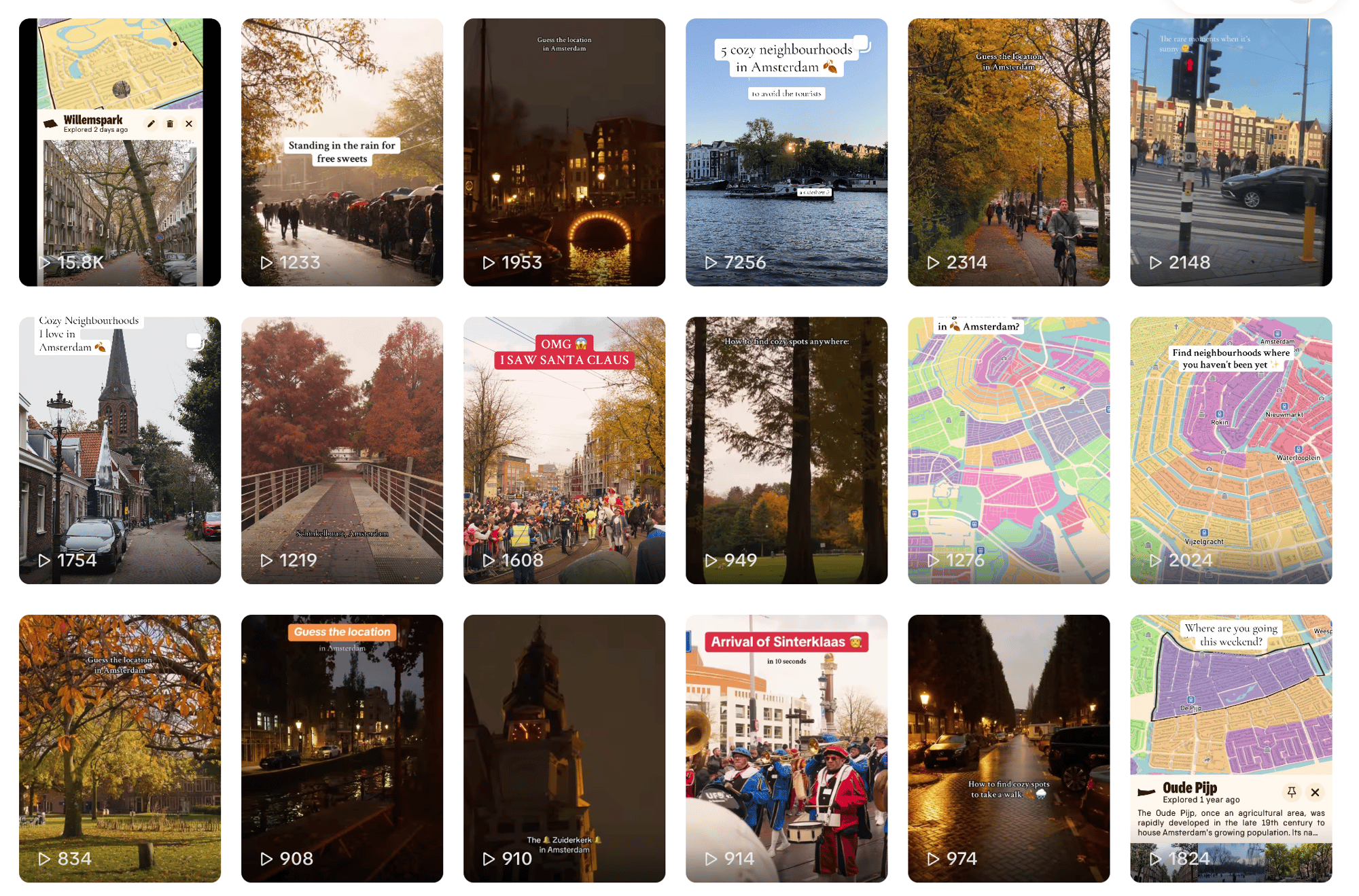
December 2024—My first foray into producing TikTok content to promote the app! There’s a lot to learn, which is super fun.
Among the feedback I receive: people are intrigued by the app, but few keep using it for long. Granting full-photo access is scary for many. And it takes a lot to kick-start the community in different cities.
January 2025—I decided to take the learnings & map / neighbourhood infrastructure to another project: Open World App, which will become much more successful.
It uses historical content which are much easier to source, and is more of a game.
